This hiking course starts at Magome-juku on the Nakasendo Highway, passes through the stone pavement of Ochiai, which retains the atmosphere of the old Nakasendo Highway, and after Ochiai-juku, ends at Nakatsugawa-juku. The course between Tsumago and Magome is very famous and many people walk it, but from Magome-juku to Nakatsugawa-juku is a quieter hiking course.
The distances between Magome-juku and Ochiai-juku, and between Ochiai-juku and Nakatsugawa-juku are relatively short. So it is possible to walk them all at once. Of course, it is also possible to walk from Magome-juku to Ochiai-juku via the stone pavement of Ochiai, and end there. From Ochiai-juku to Nakatsugawa-juku, you walk on a paved road only.
It is a paved road except for the cobblestone section of Ochiai. But it is not an arterial road and there are not many cars passing by.
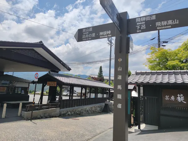
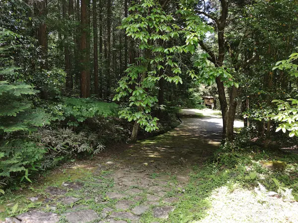
The hiking course starts at the intersection near Magome bus stop. Follow the signposts at the four corners of the entrance to Magome-juku and walk down the hill. The path to Nakatsugawa is generally paved in different colors, so it is unlikely that you will take the wrong route.
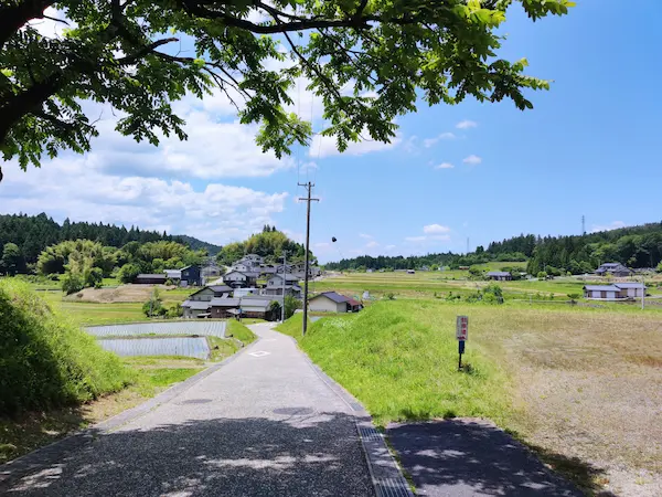
As soon as you start descending, you will see a rural landscape. The path continues like this for some time.
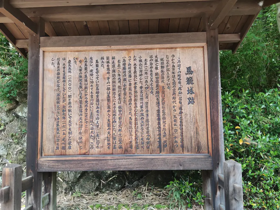
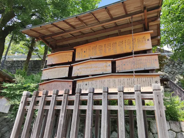
After descending for a while, there is an information board for the ruins of Magome Castle. The castle is said to date from the Muromachi period (1336-1573), and was the residence of Kiso Yoshimasa, who turned to Toyotomi Hideyoshi during the Battle of Komaki-Nagakute.
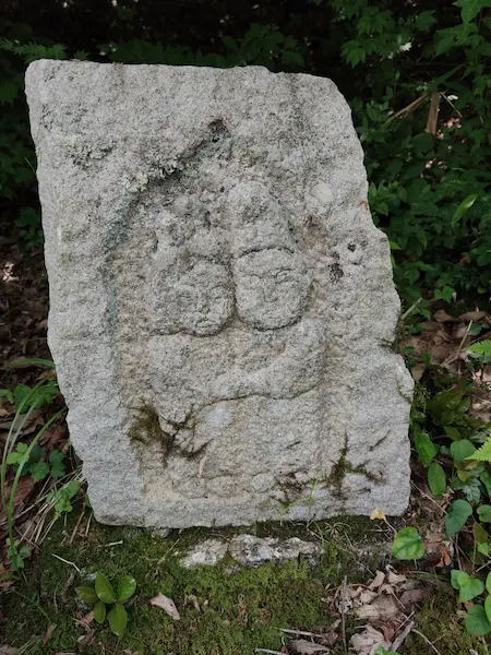
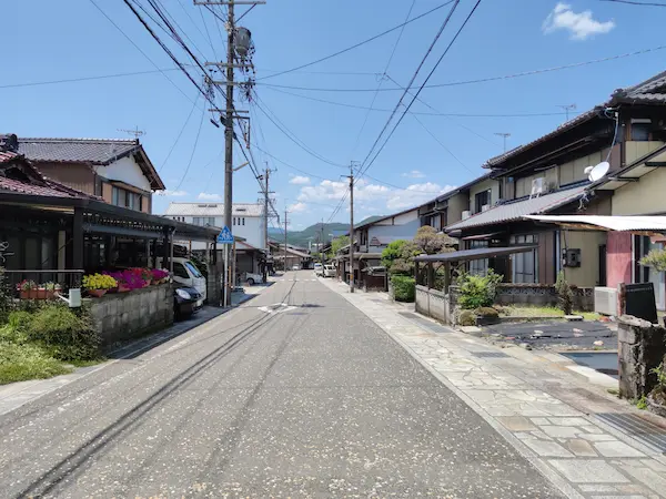
As you follow the road, you will see things here and there that remind you of history. There were also several old private homes and guest houses along the way.
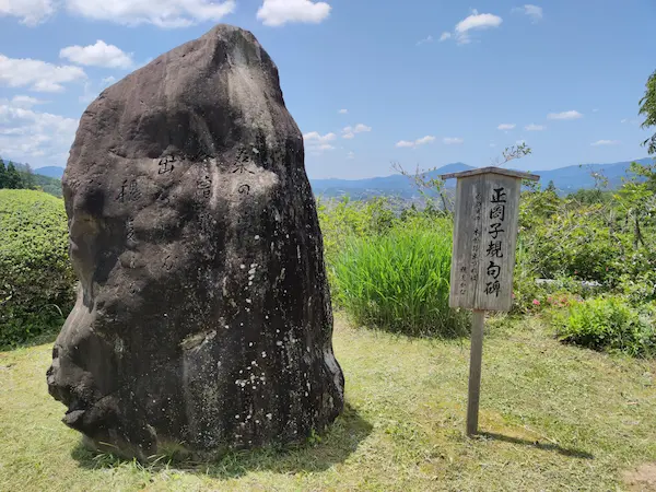
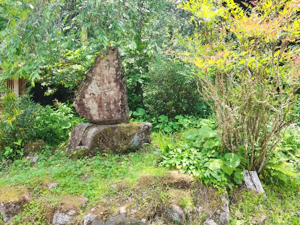
At the place where the view opens up, there is a monument with a haiku by Masaoka Shiki. Shiki Masaoka seems to have passed through this area in 1891.
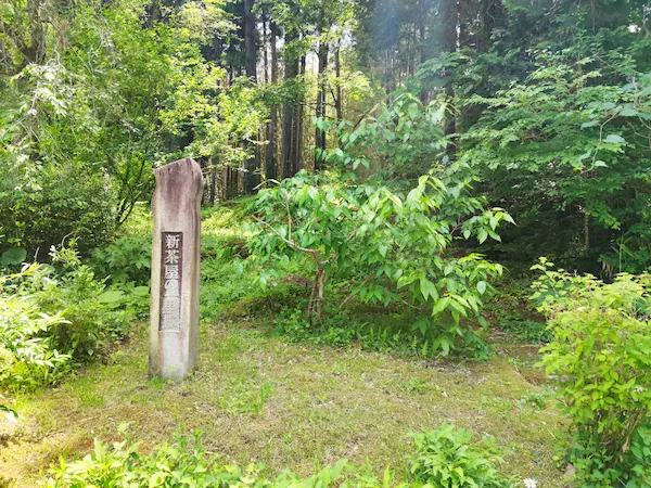
Soon, the famous “Kiso Road North of Here” monument. This used to be the border between Mino and Shinano. Now, Magome has been incorporated into Nakatsugawa City, so both sides are in Gifu Prefecture.
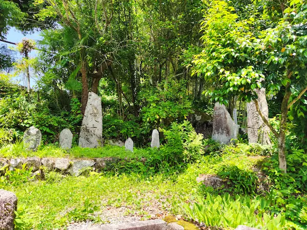
Nearby is the Ichirizuka of Shinchaya. The east side is the existing mound and the west side is a reconstruction.
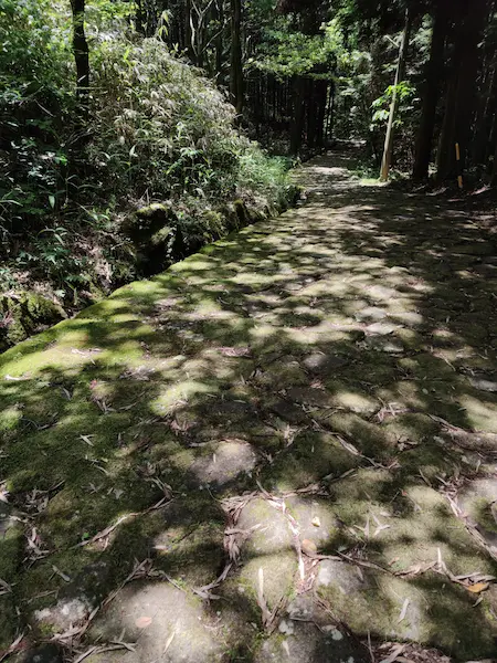
Ochiai’s stone pavement
The cobblestones of Ochiai are for pedestrians only. The moss-covered cobblestones continue under dimly lit trees. Only a small section remains from that time, and the rest is a reproduction. It is said that the stone pavement in Ochiai was built by the Owari Clan, which had jurisdiction over this area in the Edo period, to protect the slope and make it easier to walk.

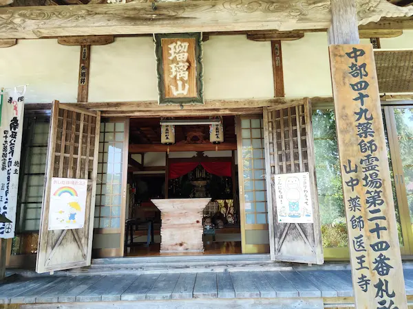
When the road comes to a small village, you will find Iioji Temple. It is also called Yamanaka Yakushi (Medicine Master). It is said to be called the “Three Yakushi” along with Gankoji Temple in Mitake Town and Horaiji Temple in Mikawa. The origin of this ancient temple is unknown. It is said that Gyoki carved and enshrined Yakushi Nyorai in the Nara period (710-794). There is a weeping cherry tree in the precincts of the temple. The first cherry tree, which was toppled by Typhoon Isewan, was reportedly planted by Kiso Yoshinaka (Minamoto no Yoshinaka).

The Nakasendo crosses a bridge over the Ochiai River. There is a weir just upstream, which is quite scenic.
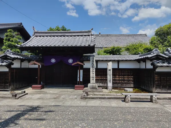
Ochiai-juku
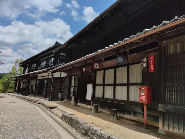
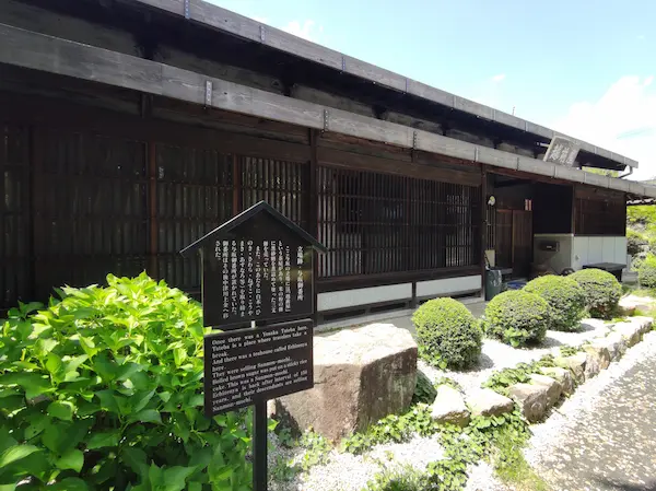
Ochiai-juku still retains some of its old buildings, which are a shadow of its former self. However, it has not become a tourist attraction and is not as bustling as Magome-juku.
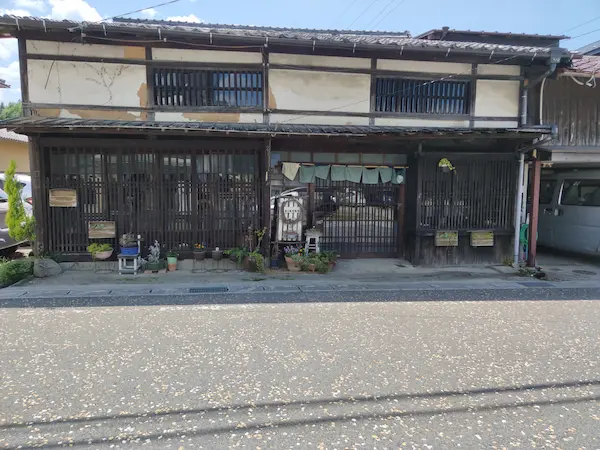
The existing Ochiai-juku Honjin was built in 1818, and it is extremely valuable that an Edo period Honjin still remains. However, it is only open on limited Sundays, so please check the Ochiai-juku Honjin website.
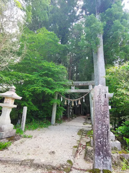
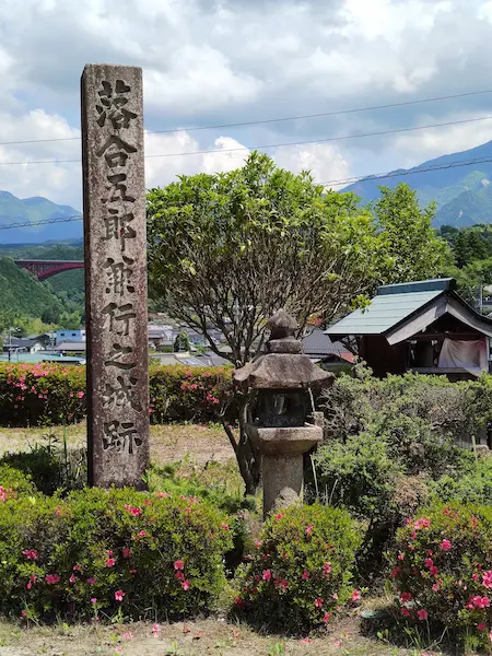
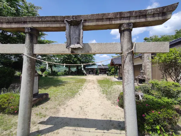
After leaving Ochiai-juku, the Nakasendo road crosses Route 19 on an elevated bridge. Just ahead is the torii gate of a shrine marked “Ogaran yon-sha (four shrines)”. The word “Ogaran” seems to come from “Garan (buildings),” and it is said that the castle residence of Ochiai Goro Kaneyuki, a chief vassal of Kiso Yoshinaka, originally existed in this area. However, nothing has been found in excavation, and there is a monument “Ruins of Ochiai Goro Kanenyuki’s castle” at the site estimated from literature.
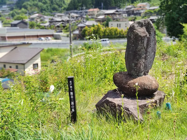
Walking down the road, I found a sign that read “Tomb of Mito Roshi Kumagai Saburo”. Kumagai Saburo joined the Tengu party, which rose up to respect the Emperor and expel the foreign influences, and was staying at the Ochiai-juku in 1864 on his way to Kyoto when he was beheaded by a fellow Tengu party member for disrupting discipline in his unit. The villagers took pity on him and buried him here. It does not seem that he was a person of particular merit or celebrity. Nevertheless, the gravestone tells the history.
The Nakasendo crosses Route 19 again. The road goes uphill from here. I thought the road would continue downhill from Ochiai-juku to Nakatsugawa-juku, but in fact it is quite undulating. Walking through a landscape of terraced rice paddies, you will come to the Yosaka Teahouse Echizenya. This is the site of the Yosaka stand. The Yosaka stand was a kind of barrier established by the Owari clan to prevent the outflow of Kiso five trees. The teahouse here was famous for “Yosaka no samon mochi” (rice cakes) made of rice flour, and is still in business as a coffee shop in an old private house.
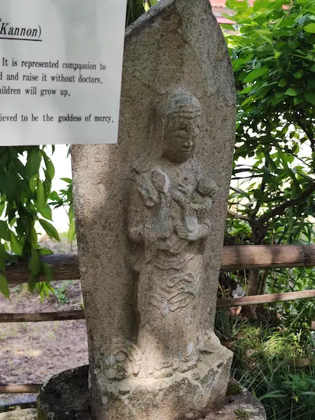
This time, walking downhill on the road, you will find the Kono Bato Kannon. Bato Kannon is often seen along the roadside.
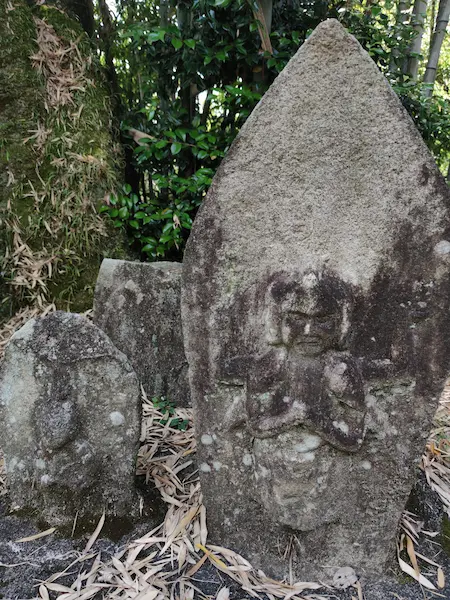
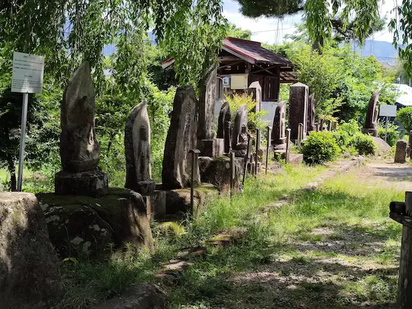
Next is the Jizodo Stone Buddha Group in Kono. It is said that stone Buddha statues that were found along the Nakasendo during the Edo period were grouped together here. The Jizo Hall, which is said to have once stood here, is said to have lost its location.
After descending a steep hill, there is the Kosatsuba (notification board) of Nakatsugawa-juku. It is already part of the Nakatsugawa city area.
The Nakasendo road passing through Nakatsugawa-juku goes through downtown Nakatsugawa. And JR Nakatsugawa Station is just a short walk away when you turn north at the intersection.
Starting point
The entrance to Magome-juku is the starting point of this course.
Course time
This course begins at Magome-juku and takes about 4 hours. Except for the stone pavement in Ochiai, all the paths are paved.
Lunch
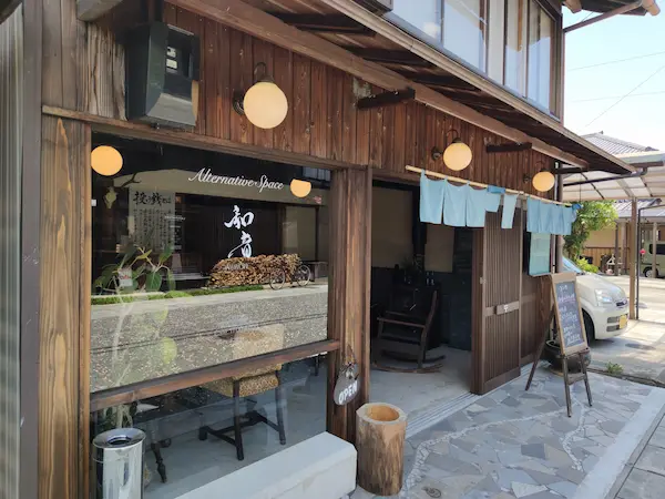
You can have lunch at the Ochiai-juku. On the day of the visit, we had lunch at a restaurant Alternative Space Waon.

Toilet
There are public restrooms in several locations along the way.
What to bring and wear
Dress for walking in the city is fine. Hiking shoes are recommended, as the cobblestones can be slippery.
Ideal time for hiking
You can visit all year round, but it is best to avoid when there is snowfall.
Neighborhood Attractions
Able-bodied visitors may walk from Tsumago-juku to Magome-juku and then to Nakatsugawa-juku in a single day.
If you arrive at Nakatsugawa Station early during the period of long sunlight, you can also make a round trip to Naegi Castle.
Comments
One response to “Magome-juku – Ochiai-juku – Nakatugawa-juku hiking”
[…] runs through Nakatsugawa. If you are a good-legged person, it is not impossible to walk from Magome-juku to Nakatsugawa-juku and make a round trip to Naegi Castle from Nakatsugawa. Or just take a bus to visit […]